    
|
|
|
       Portulan CGA5B in tube ISBN 88-86251-55-6 Price: € 520,00 |
PORTULAN CGA5b
ancient nautical maps from the Estense library 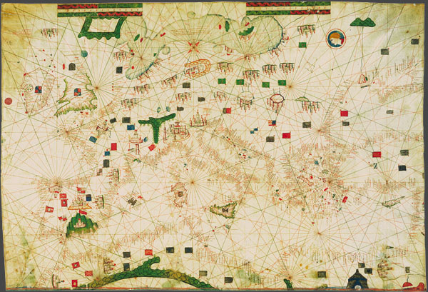 ‘Portulans’ are medieval nautical maps, provided with a wealth of geographical coastal names, conceived for being used by seafarers. Due to the fact that they used to be frequently rolled up and constantly consulted aboard, the surviving ‘carte da navigar’ are extremely rare and not always in good condition.
Portulan C.G.A.5.b (Majorca, 1450-1460 ca.), 61 × 90 cm, shows the Mediterranean basin and the Atlantic from Norway to Morocco. Less decorated than the previous one, it was likely a real ‘carta da navigar’ to be used on board by seamen. The cities of Barcelona, Valencia, Santiago de Compostela, Granada, Venice and Genua are singled out. Just few natural elements are used, whereas symbols of the human presence – such as flags, shields and towns – are used. Also available the complete collection of 3 portulans in a box, together with the commentary volume, the certificate of authenticity, a wooden-bronze paperweight and a magnifier. 
|
||