
  
Map, cm 105x220,
1502, 750 copies
ISBN 88-86251-88-5
Price: € 1.680,00
|
|
CANTINO'S MAP
Charta del navichare per le isole novamente trovate in la parte de l'India
Il Bulino edizioni d'arte, Modena
Biblioteca Estense Universitaria, Modena

cm 105x220
in a case, with commentary
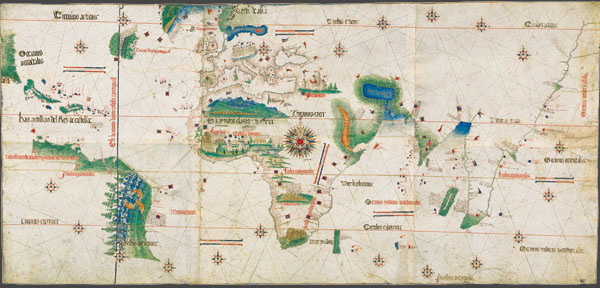
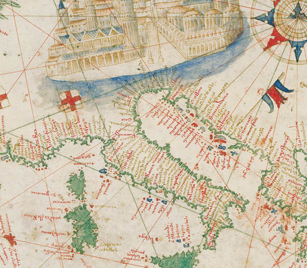
It is unanimously regarded as the most beautiful among Renaissance geographical maps and it bears witness to the discovery of America. It was manufactured and illuminated in Portugal in 1502, right after Columbus’ and Vespucci’s voyages. It is drawn on six sheets of vellum joined together to make up a single 105 × 220 cm sheet. It was probably commissioned by ambassador Alberto Cantino to supply the Duke of Ferrara with documents showing the new dimensions of the world and the importance of the latest geographical discoveries.
The planisphere shows the coasts of the Caribbean and Brazil (it is the most ancient representation of the New World in Italy), separated by the ‘raya’, the line that divided Portuguese colonies from the Spanish ones. Even though it is one of the first maps that represent the world without applying the Ptolemaic tradition, Cantino’s Map is still influenced by it, with reference to some stereotypes to which even after Columbus’ discoveries is still entrusted, such as the Tower of Babel, the realm of Prester John or Eden. In spite of the definition charta del navicare, that is to say a map used for sailing, it is for sure a planisphere realized for court geography, to be studied and contemplated.
Facsimile edition
This new edition of the Map, promoted by the Italian Ministry of Culture and presented by Laura Federzioni and Marco Cattini, is a joint-publication Il Bulino-Biblioteca Estense Universitaria. The facsimile has been printed in 5 fragments subsequently joined and lined together, presented in a special case (110 × 16 × 16 cm) together with the commentary volume by E.Milano and A.Battini and the certificate of authenticity.

|
|


