    
|
|
|
       Portulan in tube ISBN 88-86251-55-6 |
PORTULAN CGA5d ancient nautical maps from the Estense library 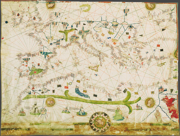 ‘Portulans’ are medieval nautical maps, provided with a wealth of geographical coastal names, conceived for being used by seafarers. Due to the fact that they used to be frequently rolled up and constantly consulted aboard, the surviving ‘carte da navigar’ are extremely rare and not always in good condition. Portolano C.G.A.5.d (Majorca, 1450 ca.) 59 × 76 cm, shows the whole basin of the Mediterranean, the coasts of the Atlantic – from the British isles to Cape Bojador in Africa –, a part of Central Europe and the territories of North Africa. European places reproduced on this map are the Alps, with their T-shape, the Pyrenees, the cities of Venice, Genua, Prague, Granada and Santiago de Compostela, the Balearic Islands. In Africa the mountains of the Atlas stand out, whereas the caption near the Red Sea recalls Hebrews’ crossing during the flight from Egypt. Also available the complete collection of 3 portulans in a box, together with the commentary volume, the certificate of authenticity, a wooden-bronze paperweight and a magnifier. 
|
||