    
|
|
|
       Portulan in tube ISBN 88-86251-55-6 |
PORTULAN CGA5c ancient nautical maps from the Estense library 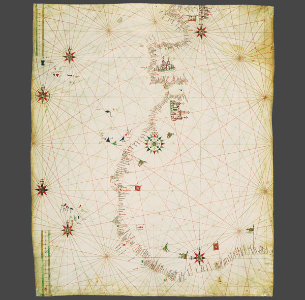 ‘Portulans’ are medieval nautical maps, provided with a wealth of geographical coastal names, conceived for being used by seafarers. Due to the fact that they used to be frequently rolled up and constantly consulted aboard, the surviving ‘carte da navigar’ are extremely rare and not always in good condition. Portolano C.G.A.5.c is the most ancient document of Portuguese nautical cartography. Anonymous and trimmed to 60 × 73 cm, it shows the Portuguese discoveries of African coasts after the explorations of Fernando Gomes in 1471-72. The emphasis on Lisbon and Ceuta and all the flags pointing out landing-places on African coasts allowed scholars to date the map between 1472 and 1482. Also available the complete collection of 3 portulans in a box, together with the commentary volume, the certificate of authenticity, a wooden-bronze paperweight and a magnifier. 
|
||